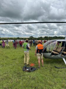
Mara Elephant Project focuses on protecting elephants and their habitats across the Greater Mara Ecosystem (GME). Vegetation and water resources for both large mammals, like elephants, and pastoralists’ livestock can be highly variable in space and time. Landscape connectivity, the ability to move unhindered across the landscape, is critical to the long-term persistence of the GME. Currently, there is a rapid expansion of fences, farms and community developments which are fragmenting the landscape and cutting off important habitats for wildlife that contain essential resources. To understand how fragmentation of the ecosystem affects people and wildlife, scientists need to map human features like livestock enclosures, fences and farms, and catalogue them over time, – an activity MEP began in 2019.

 We start with field researchers who are collecting geospatial data using motorbikes and an application developed by MEP and a generous Canadian based volunteer developer, Ray Rao, called TerraChart. The app allows researchers to map roads, fences, and infrastructure while also viewing a current map so that their efforts aren’t duplicated. The data collected through TerraChart is then cleaned and organized before it is put into the Landscape Dynamics (landDX) database, which provides a central and open-source repository for these data that is continually updated as more data is collected. The Landscape Dynamics database covers ~30,000 km2 of southern Kenya and the data includes 31,000 livestock enclosures, nearly 40,000 kilometers of fencing, and 1,500 km2 of agricultural land. Other conservation organizations contribute data to build the landDX database, which is a good example of how collaborations and data sharing between organizations can provide tools that will help improve research and conservation of wildlife and wild spaces.

The data has been used to create a basemap that provides the base for MEP’s EarthRanger system so that all of our asset movements are shown over the basemap created of the ecosystem. Then, when paired with animal location data, MEP can study how elephants and other species are responding to landscape changes. For example, you can see in the below figure the red lines, which represent fences.

By visualizing the elephant movements in the context of fences, roads and human settlements, we are able to better understand why elephants move the way they do and how they change patterns in relation to changes in the ecosystem.

The publication “Wide-scale subdivision and fencing of southern Kenyan rangelands jeopardizes biodiversity conservation and pastoral livelihoods: Demonstration of utility of open-access landDX database” published in 2022 in Frontiers in Conservation Science which MEP Director of Research and Conservation Dr. Jake Wall co-authored, dives more in depth into this challenge. The data collected in landDX and the resulting geospatial layers created for the Greater Mara Ecosystem are shared with partners to help inform their protection efforts and to help answer fundamental ecological questions we’re all working together to solve.
“The maps have significantly enriched Asilia's daily operations, serving as essential tools to enhance guest experiences by providing in-depth insights into the Mara landscape and showing them where they are in our ecosystem. Additionally, by using MEP-branded maps, this has created a conversation opportunity for guides and managers to tell guests more about the work that MEP does. The maps have also provided a visual representation of critical features such as wildlife corridors, water sources, and habitats. This has aided us in strategic planning, enabling more informed decision-making especially regarding resource allocation through our positive impact initiatives.”
Sustainability Analyst Asilia Kenya Grace Mwangi
The landDX database is featured in a paper co-authored by Dr. Wall “Landscape Dynamics (landDX) an open-access spatial-temporal database for the Kenya-Tanzania borderlands” published in Nature Scientific Data in 2022. The data featured in this paper was collected from a variety of partners and sources across the region including South Rift Association of Land Owners, Aarhus University, Kenya Wildlife Trust and MEP. MEP is grateful to our research partners Kenya Wildlife Service, Wildlife Research and Training Institute, Narok Country Government and Maasai Mara Wildlife Conservancies Association for supporting this effort.
Mara Elephant Project is dedicated to contributing and developing conservation technology that solves difficult challenges that exist in ecological data collection and analysis and making these solutions available for all conservationists to working to protect wildlife and wild spaces.