There’s a new area of study in the conservation field called “movement ecology” that’s being expanded on by a new paper just published in Science Magazine. A group of movement ecologists used a unique GPS-tracking database of 803 individuals across 57 species to track their movements. What they found was that with 50 – 70% of the Earth’s surface is currently modified by human activities such as agriculture and expanding infrastructure, ecosystems worldwide are being altered. In response, mammals are changing their movements in human-modified landscapes: movements of mammals in areas with a comparatively high human footprint were on average one-half to one-third the extent of their movements in areas with a low human footprint.
MEP collared elephant Kiambi.
“Mammals living in human-modified landscapes were moving less than mammals living in more natural areas. There are several possible causes of this reduction in movement. For example, barriers created via habitat fragmentation or infrastructure could physically prevent animals from moving. Another possibility is the increased abundance of resources such as crops or artificial water sources that reduce the need of mammals to travel longer distances. Also, the response of mammals may not only be behavioural, but some species may no longer occur in areas that are modified by humans, specifically those that exhibit long-range movements (e.g., migration). Overall, the response of mammals to human activities is complex, with multiple human activities often impacting individuals at the same time, as well as both species’ and individuals of the same species responding differently to humans depending on the context. I see this study as the first step to examining how humans are impacting animal movements. I believe future research should focus on examining the underlying causes and consequences of reduced movement with the goal to use this information to help develop conservation strategies. One key conservation goal is to maintain landscape connectivity enabling mammals to move unhindered. One example of this is the implementation of wildlife corridors that enable mammals to move between suitable habitats. It is important that land-use planning balances the needs of human activities with the needs of wildlife.” Marlee Tucker a Postdoctoral Researcher at the Senckenberg Biodiversity and Climate Research Centre and Goethe University, Frankfurt
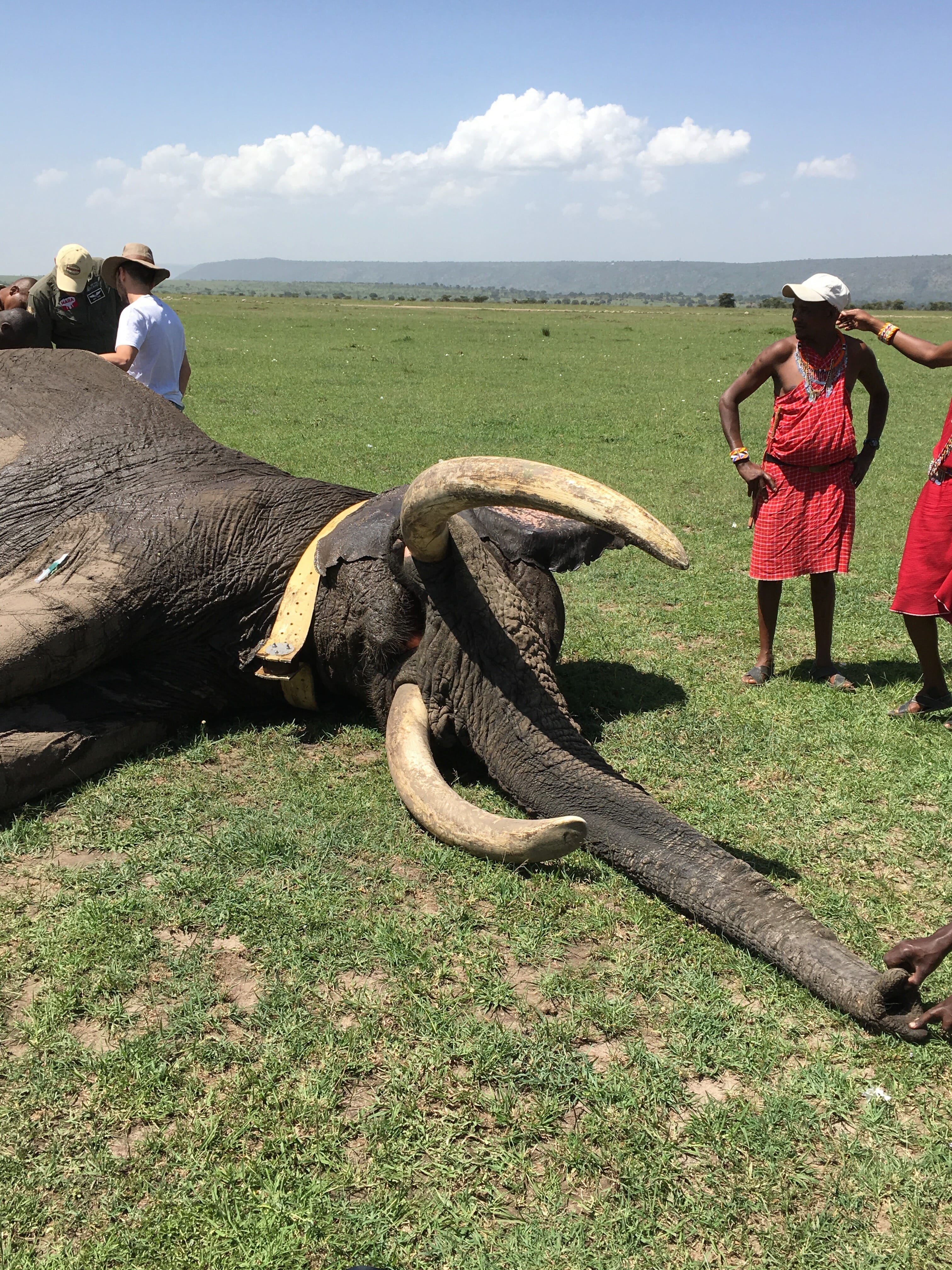
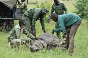
Collaring bull elephant Kegol in early 2018.
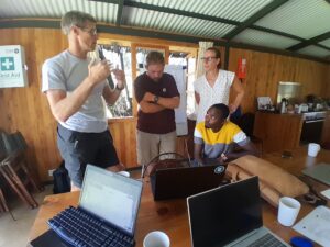
One of Mara Elephant Project’s main goals is also to use elephant movement data obtained from our 20 active collared elephants to help develop conservation strategies that maintain landscape connectivity which will enable elephants to move freely. MEP’s approach of collaring, monitoring and researching elephants is a key component to ensuring we meet our mission objectives, one of which is the influence of land-use planning in the Mara ecosystem. Currently (Jan 2018), Mara Elephant Project has 20 collared elephants that we monitor via Google Earth daily. MEP’s collared elephants provide data that is being used daily to mitigate human-elephant conflict, inform ranger deployment and anti-poaching work, and promote transboundary cooperation within the wider ecosystem. The collar software also includes alarms for immobility, geo-fence breaches and streaks (when an elephant moves quickly potentially signifying it is in danger), which MEP reacts to at a moment’s notice.
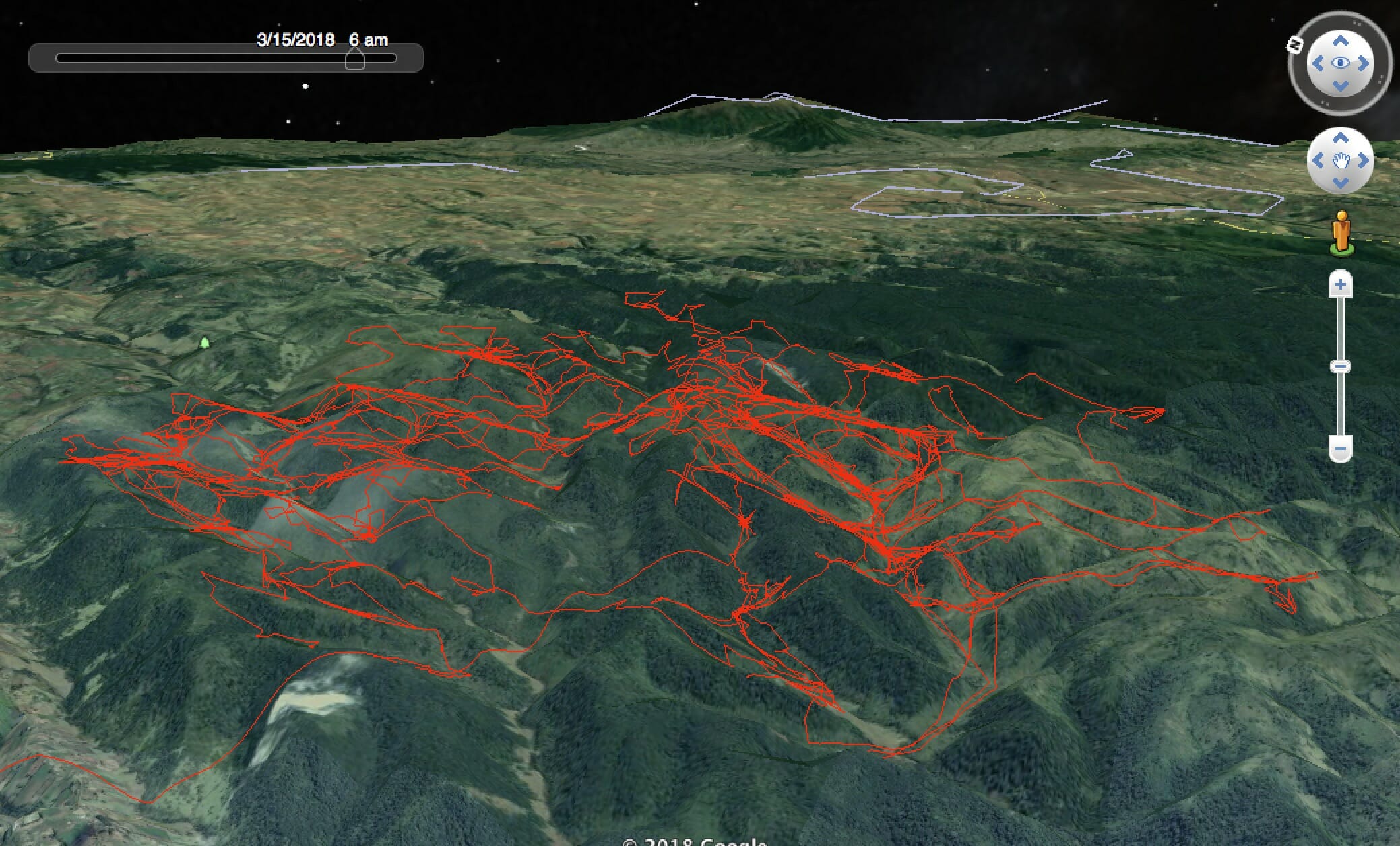
Collared elephant Nancy’s movements throughout the Mau Forest.
We focus on candidates that will gather useful spatial data, meaning elephants in border areas, areas of conflict or areas outside conservancies or national reserves. We are also looking for candidates that represent crop raiding elephants identified across the dispersal area and candidates that represent large herds. The collared elephants in most cases represents a whole herd that may be at risk.
The monitoring of elephants and supporting that aspect of MEP’s operations is extremely important. Through all of our monitoring, MEP generates monthly tracking reports, constructs density and movement maps, with partner Save the Elephants, and populates a shared geo-fence database. Each day coordinates are sent to ground patrols who use these to check on the elephants. Depending on the satellite image quality, it is possible to see settlements near the collared elephant. This information is used to anticipate possible human-elephant conflict incidents and intervene before it occurs. Through the aerial monitoring program, we have identified the collared elephants represent between 400 and 600 elephants, as counted each month.

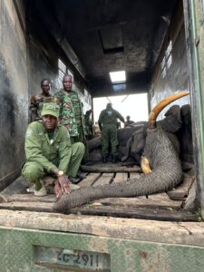
Collared elephant Mytene’s movements into the Serengeti where he was poached in April 2018.
The data collected from MEP’s elephant collars is the single best indicator for identifying elephant density hotspots, defining critical habitat and corridors, and illustrating elephant movements to target audiences. Combined data from a sample number of elephant collars spread across the elephant population present an accurate extent of the current elephant rangeland. The ongoing collection of data and further analysis must continue to provide the evidence underpinning the communications and advocacy efforts of the organization to protect this critical habitat into the future. Not only for elephants, but all wildlife that are represented by this umbrella species.